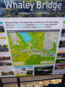

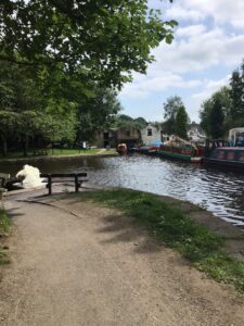
I don’t suppose I had heard much of Whaley bridge in advance of August 2019, when the small town reached the national news owing to the impending disintegration of the Toddbrook reservoir to the west of the settlement. After much rain, the dam was at real risk of collapse and over 1,000 were evacuated from their homes in case the worst should happen. The RAF and emergency services were tasked with removing water to reduce the level, and therefore the threat, and after a week the Canal and River Trust announced that the level was down by 8.4m, and people were allowed back.
So when looking for somewhere interesting to visit, I thought Whaley Bridge would be an interesting place to go, with the railway line to Buxton forming part of that tangled skein of routes to the south of Manchester. I was travelling from Manchester Piccadilly on a through ticket from Huddersfield to Disley, with a separate ticket for the last three stations to Whaley Bridge. The railway has been there for some time, since 1857, but the canal got there first in 1800, and whilst it is often thought that canals were replaced by railways fairly quickly, in fact they co-existed in many places for a considerable time, until leisure traffic replaced industrial traffic on the canals in the 1950s and 1960s.
I arrived in the early afternoon from Manchester, and was intending to walk up and have a look at the offending reservoir, but local notices indicated that the pedestrian routes to the reservoir were closed off owing to engineering works, and I knew I would be wasting my time finding a route round a long way to find the reservoir. Alongside the two platform station stood the Jodrell Arms, once the largest pub in the town, but now closed and boarded up. The rest of the town looked rather more inviting and I noticed near the top of an old incline railway was a pub, marked on a Victorian map as the Cock Inn.
I rounded the corner past a couple of tea rooms doing good business on the pavement, and down a little lane to the River Goyt which was the bottom of the incline railway. All evidence of the winding engine has done, but the large semi-circular brickwork surrounding what had been there once was clearly visible. And on following the path to the main road underneath the present railway, I found the Cock Inn, a large and friendly pub still doing good business 150 years after the map first depicted it, and enjoyed a late lunch and a pint of golden ale.
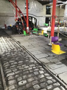
Whaley Bridge has a variety of independent shops, including the “Blythe House Hospice Department Store”, a large charity shop. I walked through the town, well supplied by the Cock Inn but there were plenty of alternatives, until I came to the canal basin. Here the canal and railway co-existed for some time, and there was a Transhipment Warehouse where railway and canal boats came together under cover to move goods from one to the other, assisted by a crane. The Grade 2 listed building was the end of the canal, with a towpath heading north. At a canal junction, a new bridge crossed the water, but I preferred the tunnel reached by a footpath either side, which the horses used to walk through (and they did this on their own after a few times) picking up the towpath to Furness Vale, the next station on the railway line, where I left the canal and joined my train home.